Kabataş
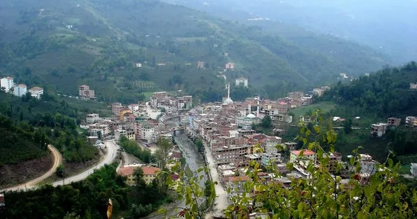
Kabataş is a district of Ordu province. The Ordu region, to which Kabataş District is located, was conquered in the 1380s and a principality named Hacıemiroğulları was established. The old name of Kabataş is Karay Village. In 1928, it was connected to Ordu province and took the name Kabataş. Later, it was connected to Gölköy district and in 1959 to Aybastı district. On February 27, 1971, the municipal organization was established and it became a town. The District was established with the law numbered 3644 dated 20 May 1990 and started its operations on 14 August 1991. There is a town called Alankent in Kabataş. The climate characteristics of the district constitute a transition between the Black Sea and Continental climate. It receives rainfall in every season. Winter months are harsher than coastal regions. Since it is rainy in every season, the vegetation consists mostly of forests. The district's economy is based on agriculture, animal husbandry and small trade. The main agricultural products grown are hazelnuts, potatoes and corn. Small amounts of barley, wheat and beans are also grown. In addition, fruits and vegetables are also grown. Livestock farming and beekeeping have also developed in recent years. The district center is 72 km from Ordu province and 40 km from Fatsa District. Kabataş district is on the northern slope of the Canik Mountains in the Central Black Sea Region and 40 km from the coast. Its altitude is 530 meters. It is surrounded by Gölköy in the east, Korgan in the west, Çatalpınar in the north, Gürgentepe in the northeast, and Aybastı in the south. In terms of climate, it constitutes a transition area between the Black Sea and Continental climate. Its main rivers are Bolaman and Armutlu. Winters are usually snowy. Hazelnuts froze in the region due to the heavy snow that fell in March 2014. This snowfall, which did not affect the coastline much, froze the hazelnuts in places whose altitude was higher than the coast. Although the annual population growth rate is 15.3, this increase rate remains below the provincial average. One of the biggest reasons for this is the rapid acceleration of migration to provinces such as Istanbul, Kocaeli, Ankara and Antalya, which are economically developed and have more job opportunities. There is one town and two villages in the district. However, as Ordu Municipality became Ordu Metropolitan Municipality with the decision of the Council of Ministers, it was decided that small towns and some villages would be connected to district municipalities. For this reason, the legal entities of Alankent Municipality and Beylerli and Kuzköy villages, which were affiliated to the district, were terminated and connected to Kabataş Municipality.


Leave Your Comments